

Geographical Distribution of Authorized Judgeships
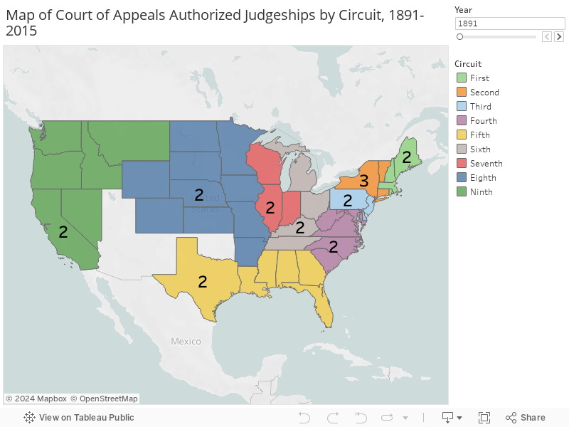
The maps on this page show the statutory allocation of federal judgeships on the U.S. courts of appeals and U.S. district courts. Since 1891, the courts of appeals have dealt with the bulk of appellate work within federal circuits. The first map reflects the changing number of judgeships authorized for each of these courts over that time. The total number of authorized judgeships may not always match the number of judges sitting on a given court due to vacancies and senior judgeships. For more information on this distinction, please visit the FJC page on the Composition of the Courts. This map excludes the Panama Canal Zone, which was part of the Fifth Circuit from 1948 to 1982.
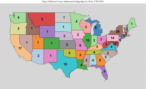
The next map illustrates the authorized district court judgeships allocated to each state over time.[1] The map employs present-day state boundaries. Thus, for example, although federal judges in Virginia served in the region now occupied by West Virginia, that region is excluded from the map prior to 1863. Congress allocated judgeships to the regions of Virginia and Massachusetts that eventually became Kentucky and Maine respectively prior to their statehood. These regions are represented by their modern state boundaries for those periods. The map shows congressionally authorized judgeships and thus does not reflect the secession of states during the U.S. Civil War. You can focus on a particular region or alter the scale of this map by selecting the "full screen" option or by hovering the cursor over the map and using the controls that appear on the left of the image.
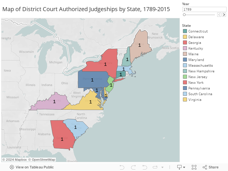
[1] Since 1948, the District of Wyoming has incorporated the areas of Yellowstone National Park that lie in Montana and Idaho. For purposes of consistency, the map uses state, rather than district, boundaries. See 62 Stat. 895 (1948).