

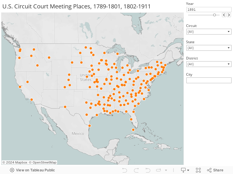
Federal Court Authorized Meeting Places
The following maps depict the locations of congressionally authorized federal court meeting places from 1789 to 2017.[1] While Congress authorized federal courts to meet in the locations indicated, federal judges did not hold court in every authorized meeting place every year. In many smaller towns and cities authorized as meeting places, there was not always sufficient federal business to warrant holding court on a regular basis. During the U.S. Civil War (1861-1865), moreover, federal courts generally did not operate in confederate territory although there were several meeting places authorized throughout the South. Several statutes authorizing meeting places have permitted courts to meet “in such other places” as they “may from time to time designate.” 26 stat. 826 (1891). Meeting places created by such designations may not be reflected on the map. However, federal proceedings could have been, and in most instances were, held in all the meeting places shown below.
You can see more information about each meeting place by hovering the cursor over the “dot” on the map. You can also view changes over time by scrolling through the years using the slider to the right of the graph, where you will also find controls to focus on meeting places in particular geographic areas. For years in which meeting places were reassigned to new districts or circuits, the map shows the meeting places in the earlier of the two jurisdictions and the text box that appears over the “dot” details the dates of the transition. This text box will also indicate whether the FJC website holds images of courthouses accommodating federal courts during the selected period. You can view these images where available by clicking once on the “dot.”
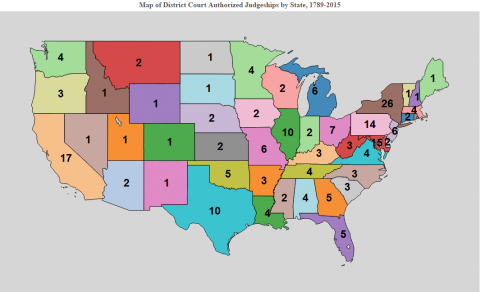
The first map shows U.S. district court meeting places across the country from 1789 to 2017. The federal system’s primary trial courts since 1912, the U.S. district courts mostly heard admiralty cases and minor criminal and civil matters prior to that date.

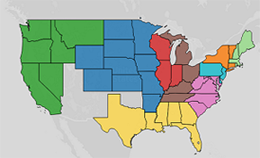
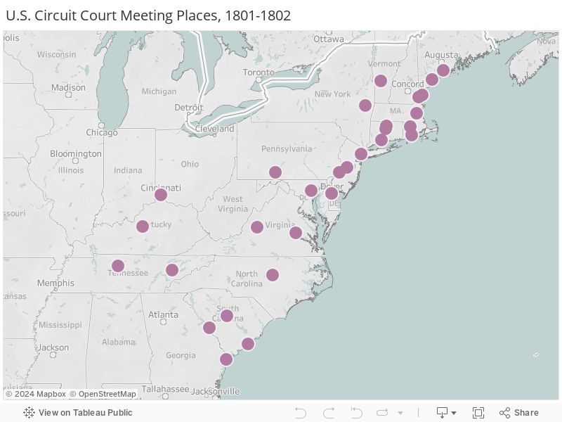
The next two maps depict meeting places for U.S. circuit courts, the federal system’s primary trial courts prior to their abolition at the end of 1911. The first map reflects the meeting places of the circuit courts in operation for most of that timespan. These courts exercised jurisdiction within judicial districts.[2] The second map reflects the meeting places of the circuit courts established by the short-lived Judiciary Act of 1801. These courts exercised jurisdiction over multi-state, numerically-organized judicial circuits.
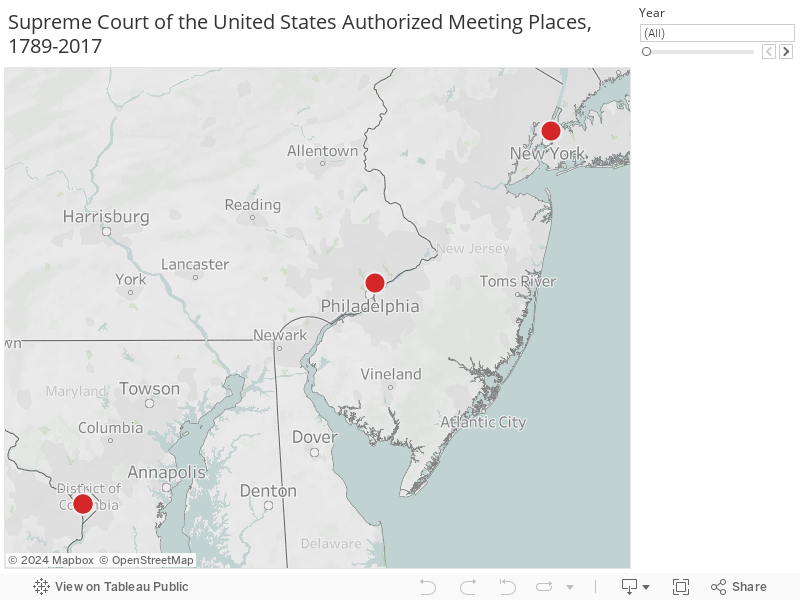
The final two maps show the meeting places for federal appellate courts. The first shows the meeting places of the U.S. courts of appeals since the creation of those courts in 1891. The final map shows the three meeting places used by the Supreme Court of the United States from 1789 to 1800, when it permanently moved to Washington, D.C.

[1] Cities are identified according to their modern-day coordinates. Several towns and cities in the modern state of West Virginia were formerly authorized as meeting places in the Western District of Virginia. Congress did not amend the relevant statutes to reflect West Virginia’s independent statehood until 1864, although West Virginia became a state in 1863. For the years prior to the statutory change, these meeting places are marked on the map with reference to the modern boundaries of West Virginia, but identified according to their statutory designation as meeting places in the Western District of Virginia.
[2] In 1879, Brownsville and Tyler, Texas were each consecutively authorized as U.S. Circuit Court meeting places in two different judicial districts. These cities were not authorized as meeting places in 1880. As a result, these meeting places have two separate entries for the year 1879 to depict their location in both districts.